


Saddle River 🇺🇸
-
Nautical Twilight begins:04:47 amSunrise:05:53 am
-
Sunset:07:54 pmNautical Twilight ends:09:00 pm
-
Moonrise:02:34 am
-
Moonset:12:10 pm
-
Moon over:07:22 am
-
Moon under:07:38 pm
-
Visibility:48%
-
 Third Quarter Moon
-
Distance to earth:367,646 kmProximity:89.3 %
Moon Phases for Saddle River
-
average Day
-
minor Time:01:34 am - 03:34 am
-
major Time:06:22 am - 08:22 am
-
minor Time:11:10 am - 01:10 pm
-
major Time:
 06:38 pm -
08:38 pm
06:38 pm -
08:38 pm
Tide Clock
Tide Graph
Times
| Tide | Time | Height |
|---|---|---|
| high | 03:11 am | 4 ft |
| low | 10:16 am | 0.56 ft |
| high | 04:03 pm | 3.44 ft |
| low | 10:31 pm | 0.92 ft |
| Date | Major Bite Times | Minor Bite Times | Sun | Moon | Moonphase | Tide Times |
|---|---|---|---|---|---|---|
|
Wed, 01 May
|
06:22 am -
08:22 am
06:38 pm -
08:38 pm
|
01:34 am -
03:34 am
11:10 am -
01:10 pm
|
R: 05:53 am S: 07:54 pm |
R: 02:34 am S: 12:10 pm |
Third Quarter Moon |
high: 03:11 am
, 4 ft
, Coeff: 111
low: 10:16 am
, 0.56 ft
high: 04:03 pm
, 3.44 ft
, Coeff: 84
low: 10:31 pm
, 0.92 ft
|
|
Thu, 02 May
|
07:16 am -
09:16 am
07:30 pm -
09:30 pm
|
02:06 am -
04:06 am
12:27 pm -
02:27 pm
|
R: 05:52 am S: 07:55 pm |
R: 03:06 am S: 01:27 pm |
Third Quarter Moon |
high: 04:16 am
, 3.97 ft
, Coeff: 109
low: 11:18 am
, 0.36 ft
high: 05:07 pm
, 3.67 ft
, Coeff: 95
low: 11:40 pm
, 0.66 ft
|
|
Fri, 03 May
|
08:08 am -
10:08 am
08:20 pm -
10:20 pm
|
02:34 am -
04:34 am
01:42 pm -
03:42 pm
|
R: 05:51 am S: 07:56 pm |
R: 03:34 am S: 02:42 pm |
Waning Crescent |
high: 05:25 am
, 4.04 ft
, Coeff: 112
low: 12:12 pm
, 0.1 ft
high: 06:12 pm
, 4 ft
, Coeff: 111
|
|
Sat, 04 May
|
08:58 am -
10:58 am
09:10 pm -
11:10 pm
|
02:58 am -
04:58 am
02:58 pm -
04:58 pm
|
R: 05:50 am S: 07:57 pm |
R: 03:58 am S: 03:58 pm |
Waning Crescent |
low: 12:41 am
, 0.33 ft
high: 06:32 am
, 4.1 ft
, Coeff: 115
low: 01:03 pm
, -0.13 ft
high: 07:11 pm
, 4.36 ft
, Coeff: 128
|
|
Sun, 05 May
|
09:48 am -
11:48 am
10:01 pm -
12:01 am
|
03:22 am -
05:22 am
04:15 pm -
06:15 pm
|
R: 05:48 am S: 07:58 pm |
R: 04:22 am S: 05:15 pm |
Waning Crescent |
low: 01:37 am
, 0 ft
high: 07:33 am
, 4.2 ft
, Coeff: 120
low: 01:52 pm
, -0.33 ft
high: 08:04 pm
, 4.69 ft
, Coeff: 143
|
|
Mon, 06 May
|
10:39 am -
12:39 pm
10:53 pm -
12:53 am
|
03:47 am -
05:47 am
05:32 pm -
07:32 pm
|
R: 05:47 am S: 07:59 pm |
R: 04:47 am S: 06:32 pm |
New Moon |
low: 02:32 am
, -0.26 ft
high: 08:28 am
, 4.27 ft
, Coeff: 123
low: 02:42 pm
, -0.43 ft
high: 08:52 pm
, 4.95 ft
, Coeff: 156
|
|
Tue, 07 May
|
11:32 am -
01:32 pm
11:16 pm -
01:16 am
|
04:14 am -
06:14 am
06:51 pm -
08:51 pm
|
R: 05:46 am S: 08:00 pm |
R: 05:14 am S: 07:51 pm |
New Moon |
low: 03:25 am
, -0.46 ft
high: 09:19 am
, 4.27 ft
, Coeff: 123
low: 03:30 pm
, -0.43 ft
high: 09:39 pm
, 5.09 ft
, Coeff: 162
|


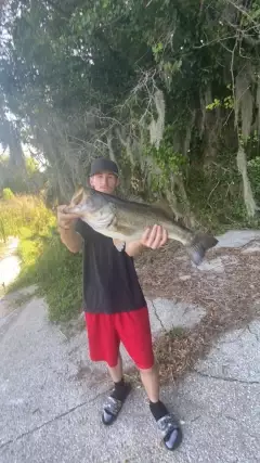
uploaded by: D2Turnt

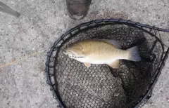
uploaded by: PT Edward fisher

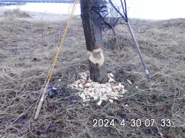
uploaded by: Charlie Pifer

uploaded by: Charlie Pifer

uploaded by: Charlie Pifer

uploaded by: Charlie Pifer

uploaded by: bariu

uploaded by: bariu

uploaded by: bariu
uploaded by: PT Edward fisher
Saddl Riveh,Sehddl-River,sydl rywr, nywjrsy,Саддл Ривэ,Сэддл-Ривер,سیدل ریور، نیوجرسی
Best Fishing Spots in the greater Saddle River area
Harbours and Marinas can often times be productive fishing spots for land based fishing as their sheltered environment attracts a wide variety of bait fish. Similar to river mouths, harbour entrances are also great places to fish as lots of fish will move in and out with the rising and falling tides. There are 4 main harbours in this area.
Forest View Boat Basin (historical) - 17km, Hook Mountain Yacht Club - 17km, Alpine Boat Basin - 18km, Julius Peterson Boat Yard - 18km
We found a total of 100 potential fishing spots nearby Saddle River. Below you can find them organized on a map. Points, Headlands, Reefs, Islands, Channels, etc can all be productive fishing spots. As these are user submitted spots, there might be some errors in the exact location. You also need to cross check local fishing regulations. Some of the spots might be in or around marine reserves or other locations that cannot be fished. If you click on a location marker it will bring up some details and a quick link to google search, satellite maps and fishing times. Tip: Click/Tap on a new area to load more fishing spots.
Coles Pond - 3km , Van Gelders Pond - 5km , Woodcliff Lake Dam - 5km , Maple Lake Dam - 6km , Suraci Pond - 6km , Wild Duck Pond - 6km , Rambaut Dam - 6km , Darlington Lake Dam - 7km , Hands Lake - 7km , Hartung Lake - 7km , Shadow Lake Dam - 7km , Ziegler Pond - 7km , Lawlin Pond - 8km , Valentine Pond - 8km , Reed Pond - 8km , Dators Pond - 9km , Lake Tappan Dam - 9km , Clark Pond - 10km , Conrad Pond - 10km , Haledon Reservoir Dam - 10km , MacMillan Reservoir Dam - 10km , Oradell Reservoir Dam - 10km , Martins Lake - 10km , Pascack Creek Bridge - 10km , Lake Idlewild - 11km , Lotz Pond - 11km , Lower Blauvelt Lake - 11km , Lake Antrim - 11km , Bear Swamp Lake Dam - 12km , Bridge Pond - 12km , Cannonball Lake - 12km , Crystal Lake Dam - 12km , Lake Tamarack Dam - 12km , Lake Vreeland Dam - 12km , Silver Lake - 12km , Grebe Pond - 13km , Barbour Mill Dam - 13km , Hinchman Pond - 13km , Ramapo Lake Dam - 13km , Smith Pond - 13km , Adler Pool - 14km , Clots Lake - 14km , Cooper Pond - 14km , North Cape - 14km , Point View Dam - 14km , Stephens Lake - 14km , Upper Erskine Lake Dam - 14km , Bockar Lake - 14km , Country Club Ponds - 15km , Furnace Road Dam - 15km , Gupsaw Lake Dam - 15km , Lake Erskine Dam - 15km , Lionhead Lake - 15km , Meadow Brook Lake - 15km , Pines Lake Dam - 15km , Pompton Lakes Dam - 15km , Swan Pond - 15km , Piermont Avenue Bridge - 15km , Alexanders Pond - 16km , Barbour Pond - 16km , Hidden Valley Lake - 16km , Highland Lake Dam - 16km , Lake Inez Dam - 16km , Midvale Dam - 16km , New Street Reservoir Dam - 16km , Pompton Dam - 16km , Raymond Dam - 16km , Scarletelli Pond - 16km , Sheffield Pond - 16km , Sheppard Pond - 16km , Swins Ponds - 16km , Toms Lake - 16km , Garrabrant Pond - 16km , Mirror Lake - 16km , Pine Meadow Lake - 16km , Ferdon Avenue Bridge - 16km , Sparkill Creek Bridge - 16km , Butchers Pond - 17km , Crestmere Lake - 17km , Dahnerts Lake - 17km , Dundee Dam - 17km , Garden Pond - 17km , Packanack Lake Dam - 17km , Spring Pond - 17km , Twin Lakes Lower Dam - 17km , Lake Wanoksink - 17km , Forest View Boat Basin (historical) - 17km , Hook Mountain Yacht Club - 17km , Adams Lake - 18km , Alpine Boat Basin - 18km , Pfisters Pond - 18km , Ringwood Mill Dam - 18km , Congers Lake - 18km , Julius Peterson Boat Yard - 18km , Great Notch Reservoir Dam - 19km , Green Brook Pond - 19km , Roveres Lake - 19km , Wanaque Aqueduct - 19km , Gurnee Lake - 19km , Lake Lucille - 19km
Comments